The Map That Erased a Family
Tom Morrison had been running cattle on the same 640 acres of Montana grassland for twenty-three years when he decided to retire and sell the ranch in 1994. The land had been in his family since 1923, purchased fair and square from a homesteader who'd proven up his claim. Morrison had the deed, the tax records, and decades of mortgage payments to prove it.
What he didn't have, according to the federal government, was a ranch that legally existed.
The discovery came during a routine title search. The prospective buyer's attorney called with puzzling news: according to federal land records, Morrison's ranch was located in the heart of the Bear Creek Wilderness Area, established in 1978 as part of a massive federal land conservation initiative. Under wilderness designation, the land was supposed to be pristine, undeveloped, and completely free of human habitation.
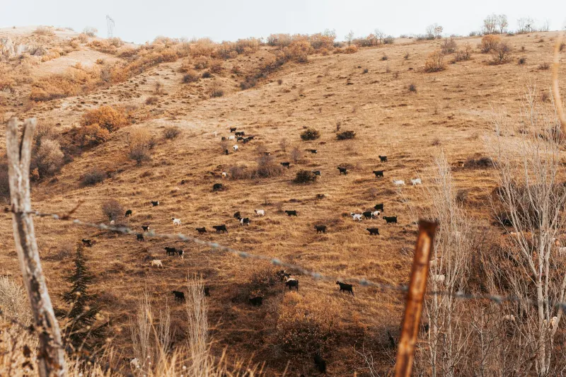
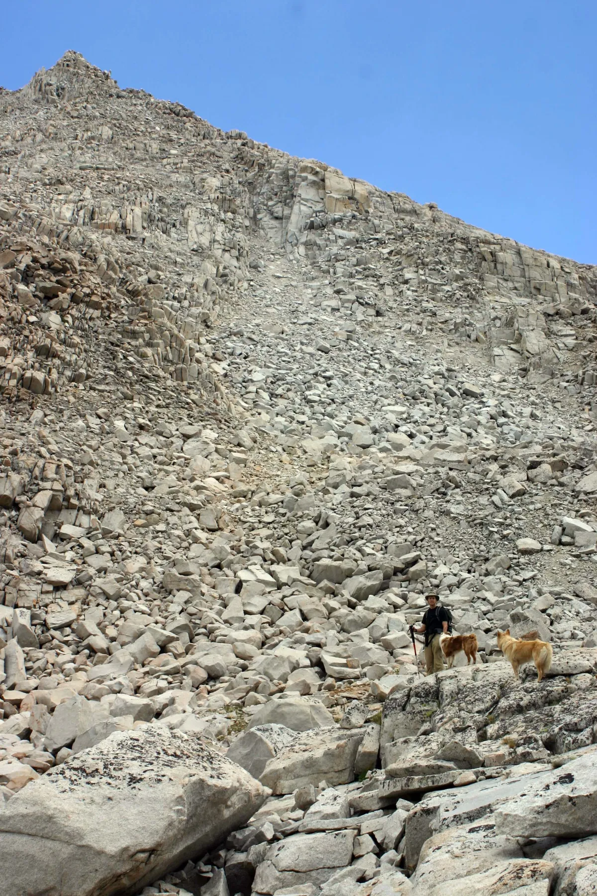 Photo: Bear Creek Wilderness Area, via www.livewild.org
Morrison's response was understandable: "Well, somebody better tell my cattle they're trespassing in the wilderness."
When Surveyors Get Creative
The mistake traced back to 1976, when federal agencies were rushing to complete environmental impact studies for potential wilderness designations across the Mountain West. Congress had mandated that vast areas of federal land be evaluated for wilderness status, and agencies were working with tight deadlines and limited resources.
 Photo: Mountain West, via matchthememory.com
The surveying team assigned to the Bear Creek area was supposed to map the boundaries between federal and private land, ensuring that any wilderness designation would only include property actually owned by the government. Instead, they made a series of errors that would take nearly two decades to unravel.
First, they misidentified a creek. The Morrison ranch sat along Bear Creek, but the surveyors confused it with Little Bear Creek, located about eight miles to the north. Second, they relied on outdated township maps that didn't reflect a 1920s boundary adjustment between two counties. Third, and most remarkably, they somehow missed the fact that an active cattle ranch with buildings, fences, and grazing operations was located in the middle of their proposed wilderness area.
The Bureaucracy of Invisibility
When the Bear Creek Wilderness Area was officially designated in 1978, Morrison's ranch was legally transformed from private property into federal wilderness. The designation came with strict environmental protections: no motorized vehicles, no permanent structures, no commercial activities, and definitely no cattle ranching.
Morrison, meanwhile, continued doing exactly what he'd always done. He ran cattle, maintained his buildings, drove trucks across his land, and paid property taxes to the county. Nobody from any federal agency ever contacted him about the wilderness designation. The Forest Service, which managed the new wilderness area, apparently never bothered to visit the land they were now responsible for protecting.
For sixteen years, Morrison operated his ranch in blissful ignorance of its official non-existence. He dealt with droughts, cattle prices, and equipment breakdowns—normal ranch problems. The federal government, for its part, proudly protected 15,000 acres of "pristine wilderness" that included an active cattle operation it didn't know existed.
The Discovery
The truth emerged only when Morrison tried to sell. His attorney, reviewing the title search results, initially assumed there had been some clerical error. Private property couldn't just disappear into federal wilderness designation, could it?
It could, and it had. Further investigation revealed that Morrison's ranch existed in a kind of legal twilight zone. His deed was valid, his property taxes were current, and his ownership was legitimate under state law. But federal law now classified his land as wilderness, which meant any human activity there was technically illegal.
The situation was so unusual that it took three different law firms to even understand what had happened. Morrison owned land that the federal government had decided didn't exist as private property. The government was responsible for protecting wilderness that included an active ranch it had never acknowledged.
Fighting for Reality
Morrison's battle to prove his ranch existed became a Kafkaesque journey through federal bureaucracy. The Forest Service initially insisted that their wilderness maps were correct and that Morrison must be mistaken about the location of his property. When he invited them to visit his ranch, they declined, saying they couldn't enter wilderness areas with motorized vehicles—apparently not recognizing the irony of refusing to visit his ranch because it was located on his ranch.
The case eventually required intervention from Morrison's congressman, two senators, and the Montana Attorney General's office. Federal agencies had to send teams of surveyors, lawyers, and environmental specialists to confirm what Morrison had been saying all along: there was indeed a working cattle ranch in the middle of their wilderness area.
The solution required an act of Congress. In 1996, eighteen years after Morrison's ranch had been accidentally erased from existence, federal legislation officially removed his 640 acres from the wilderness designation. The bill's language was diplomatically vague, referring to "boundary adjustments" and "technical corrections" rather than acknowledging that the government had spent two decades protecting a wilderness that included an active cattle ranch.
The Cost of Cartographic Fiction
By the time Morrison's property was officially restored to private status, he had spent more than $47,000 in legal fees and lost two potential sales. The federal government spent an estimated $200,000 on surveys, legal reviews, and congressional hearings to fix the problem.
More remarkably, the government's wilderness protection efforts had been completely fictional for nearly two decades. Forest Service annual reports had praised the pristine condition of the Bear Creek Wilderness, apparently unaware that cattle were grazing there year-round and that ranch equipment was crossing the "roadless" area regularly.
When Maps Trump Reality
The Morrison ranch case illustrates a peculiar feature of modern governance: the power of official maps to override physical reality. For eighteen years, federal agencies managed a wilderness area that existed primarily on paper, while Morrison operated a ranch that had been bureaucratically erased from existence.
The case also revealed how federal land management agencies can become isolated from the landscapes they're supposed to manage. The Forest Service had detailed maps, environmental impact studies, and management plans for the Bear Creek Wilderness, but apparently no one had ever actually visited the area to see what was there.
Morrison finally sold his ranch in 1997, though at a reduced price due to the years of legal uncertainty. The new owners inherited a property with a unique distinction: it was probably the only working cattle ranch in America that had spent eighteen years as federal wilderness.
Today, the Bear Creek Wilderness Area covers about 14,400 acres of genuine wilderness. Morrison's former ranch, now officially recognized as private property, sits just outside the wilderness boundary where it had always belonged. The corrected maps show the wilderness area with a neat 640-acre notch cut out of its center—a permanent reminder of the day the federal government accidentally made a cattle ranch disappear.